UAVs to Save Cultural Heritage in Emergency Scenarios
Protecting cultural heritage during and after a disaster is a crucial objective for emergency services. Situational awareness is essential and requires a continuous flow of information from different sources, ideally in real time. In this context, unmanned aerial vehicles (UAVs) have proven to be valuable tools for collecting data in dangerous situations, allowing damage assessment and planning interventions without exposing personnel to risks. In particular, the use of drones during the 2016 earthquake in central Italy highlighted their value in protecting cultural heritage, demonstrating how innovative technologies and data analytics can improve emergency management. The integration of these technologies into broader systems, including sensors, cutting-edge platforms and image analysis models, is crucial to provide essential information on the condition of artefacts and the damage they may suffer.
Within this context, research and end-users’ needs in the realm of Cultural Heritage protection aim for integrated systems. These systems should incorporate sensors and cutting-edge platforms to provide essential information about the conditions of artifacts and the damages they may incur due to natural or man-made factors. Following this strategy, diverse and dispersed data sources should communicate with the central system, creating a continuous flow of data and information through traditional internet channels.
In this framework, the sensor infrastructure, utilizing UAVs for surveying, diagnosing, and monitoring open-space Cultural Heritage sites, becomes a vital component of a system. This system would require innovative technologies and approaches to recognize images captured by UAVs, coupled with models and techniques for information fusion.
Leveraging complex event processing techniques and technologies, the gathered information and/or inferred domain events are aggregated and correlated. This process aims to identify potential dangerous or critical situations, including the recognition, validation, and localization of signals and events that may necessitate monitoring, surveying, or warnings for disaster prevention, along with assessing the level of risk (Surveillance & Monitoring Services, Surveying & Diagnosis Services, Quick Damage Assessment Services). As a case study, we examine the 2016 earthquake in Central Italy.
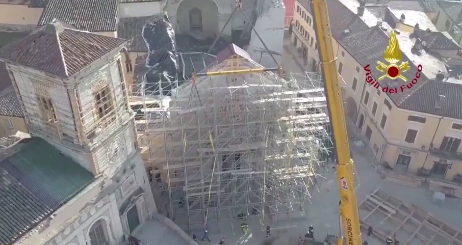
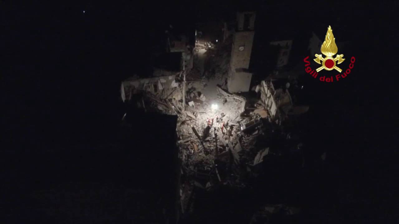
During the 2016 earthquake in central Italy, there was a notable increase in the utilization of drones by Italian firefighters (CNVVF) from the early stages of the emergency. The purpose was to swiftly and comprehensively assess the extent of damage suffered by major historical and artistic buildings. This activity was part of new procedures adopted to secure buildings damaged in large-scale emergencies. The drones, equipped with instrumentation for photographic surveys, enabled the acquisition of gigabytes of high-resolution images of post-seismic event locations. Specifically, drone flights assisted in evaluating the damage to historic buildings and churches of great artistic importance, located in restricted or prohibited areas. The analysis of this data was crucial for assessing the risk of further collapses and designing effective shoring systems to support unstable structures.
The aerial photogrammetric data obtained through daily drone sorties were processed using specific input software for the rapid creation of 3D models. These models were then integrated with cadastral and geomorphological data, providing valuable support for understanding the operating environment where firefighting teams conducted search and rescue operations. Additionally, this post-processing facilitated a more accurate assessment of the damage and, consequently, an early cost estimate during the initial stages of the emergency.
While the accuracy of the obtained data (e.g., point clouds, surface models, and orthophotos) may not match that of other systems like LIDAR, it serves as a valuable rescue tool, offering a good evaluation of the severity of the scenario and estimating the time required for refurbishing primary infrastructure such as roads and electrical networks.
In this specific context, special units of the Italian Fire Corps (CNVVF) with expertise in topography during rescue operations scoured the quake-affected areas. The VHF radio network of the CNVVF, equipped with a GPS module and interfaced to specific software on tablets for tracking and geo-referencing, allowed them to create maps. These maps integrated information gathered from multiple sources, processed by GIS system experts, and transformed into shapefiles or other widely used formats on platforms such as Google Maps.
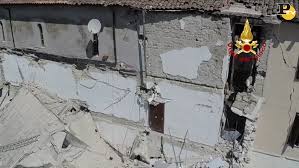
In scenarios involving the assessment and restoration of safety for historic or cultural buildings, research such as that conducted in the H2020 STORM project proves invaluable. The need for a rapid and secure assessment of damage to historical or cultural buildings prompted the extensive use of UAVs by the CNVVF in the 2016 earthquake. While UAV-captured images were beneficial for emergency tasks, their utility could be enhanced by comparing data detected by LIDAR before and after the disaster event. The STORM project’s pilot scenarios aim to integrate UAVs, LIDAR images, and shared procedures between cultural heritage managers and CNVVF, allowing them to assess damages caused by natural events with the highest possible resolution.
The use of drones in the context of cultural heritage protection in emergency situations represents a significant step forward in risk management and disaster response. The ability to rapidly collect high-resolution visual data, create 3D models and integrate this information with other georeferenced data allows for more accurate damage assessment and more effective intervention planning. Although the accuracy of drone data may not match that of systems such as LIDAR, they offer a valuable relief tool, providing a good assessment of the severity of the situation and allowing to estimate the time needed to restore primary infrastructure. Projects such as H2020 STORM aim to further integrate technologies, combining drone data with LIDAR data for an even more accurate damage assessment.
The experience of the 2016 earthquake in central Italy highlighted how the use of drones can improve the safety of rescuers, allow the assessment of otherwise inaccessible areas and contribute to a faster and more effective response. Ultimately, the adoption of these innovative technologies and their integration into comprehensive systems are essential for the protection of cultural heritage in the event of a disaster, ensuring the safeguarding of priceless assets.
